Homepage Content (home.txt)
Hero Tagline (Consider using this in a prominent Heading block, possibly within a Cover block):
From Gullies to Green Corridors — Abia Leads Africa’s Sub-national Climate Action.

Extended “About the Site” Copy (Main content area):
Welcome to the Abia NEWMAP-EIB Climate-Adaptation Hub, the authoritative digital gateway to one of Africa’s most ambitious sub-national climate programmes. Here you’ll find interactive maps, drone-verified monitoring dashboards, engineering designs, funding models and human-impact stories—all in one open-data repository designed for practitioners, donors, academics and concerned citizens.
Whether you’re a UNFCCC negotiator assessing Article 6 readiness, a climate-finance institution seeking investible projects, or a local student tracking changes in your community, this portal turns real-time field data into global insight.
Explore how Abia State combines hard engineering, nature-based solutions and cutting-edge digital MRV to stabilise ravines, protect livelihoods and generate carbon-credit potential—setting a replicable blueprint for the rest of Nigeria and beyond.
Suggested Sections (Use Heading blocks for titles, Paragraph/Columns/Buttons for content):
Key Achievements (NEWMAP Phase 1)
Building on the success of NEWMAP Phase 1 (2013-2022), NEWMAP-EIB continues to deliver impactful results. Phase 1 highlights in Abia State include:

Quantified results including households benefited, land reclaimed, and people trained.

Specific infrastructure and support provided, such as roads, boreholes, and training.
- 5 Gully Erosion Sites Remediated
- 50.66 Hectares of Land Reclaimed
- 1,890 Households Directly Benefited
- 1,466 Persons Trained (Livelihoods)
- 45.66 km of Roads Constructed
- Solar Power Solutions Implemented (Street Lights, Boreholes, Drier Chamber)
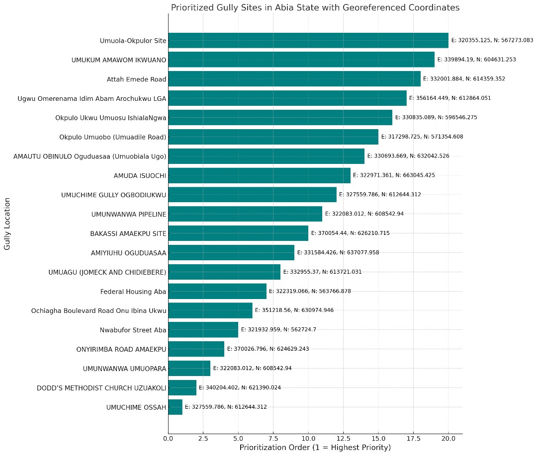
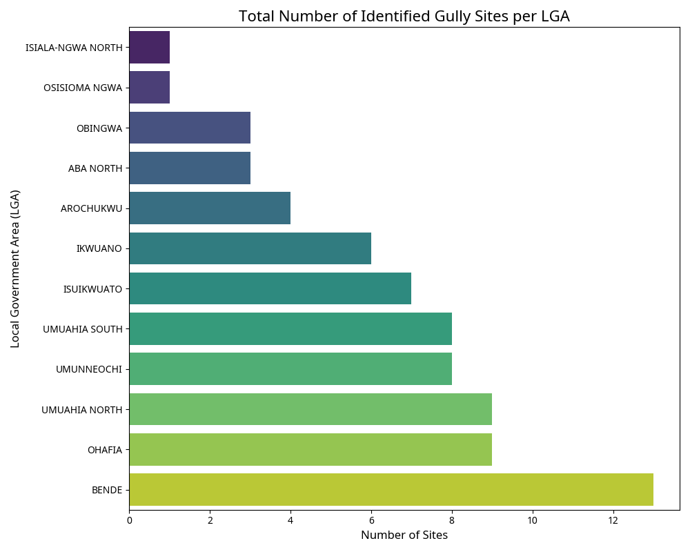
NEWMAP-EIB (2024-2029) expands on this foundation, addressing ~80 identified sites across 14 LGAs.
Explore Our Impact
(Use Columns or Cards blocks to link to key sections)
- Interactive Map: Visualize project sites, progress, and environmental context. [Link to Map Page]
- Data Room: Access detailed project documents, datasets, and reports. [Link to Data Room Page]
- MRV Live Feed: See real-time monitoring data from the field. [Link to MRV Page]
- Stories & Media: Discover the human impact of NEWMAP-EIB. [Link to Stories Page]
Get Involved
(Button or link)
Learn how you can partner with us or access project data. [Link to Get Involved Page]